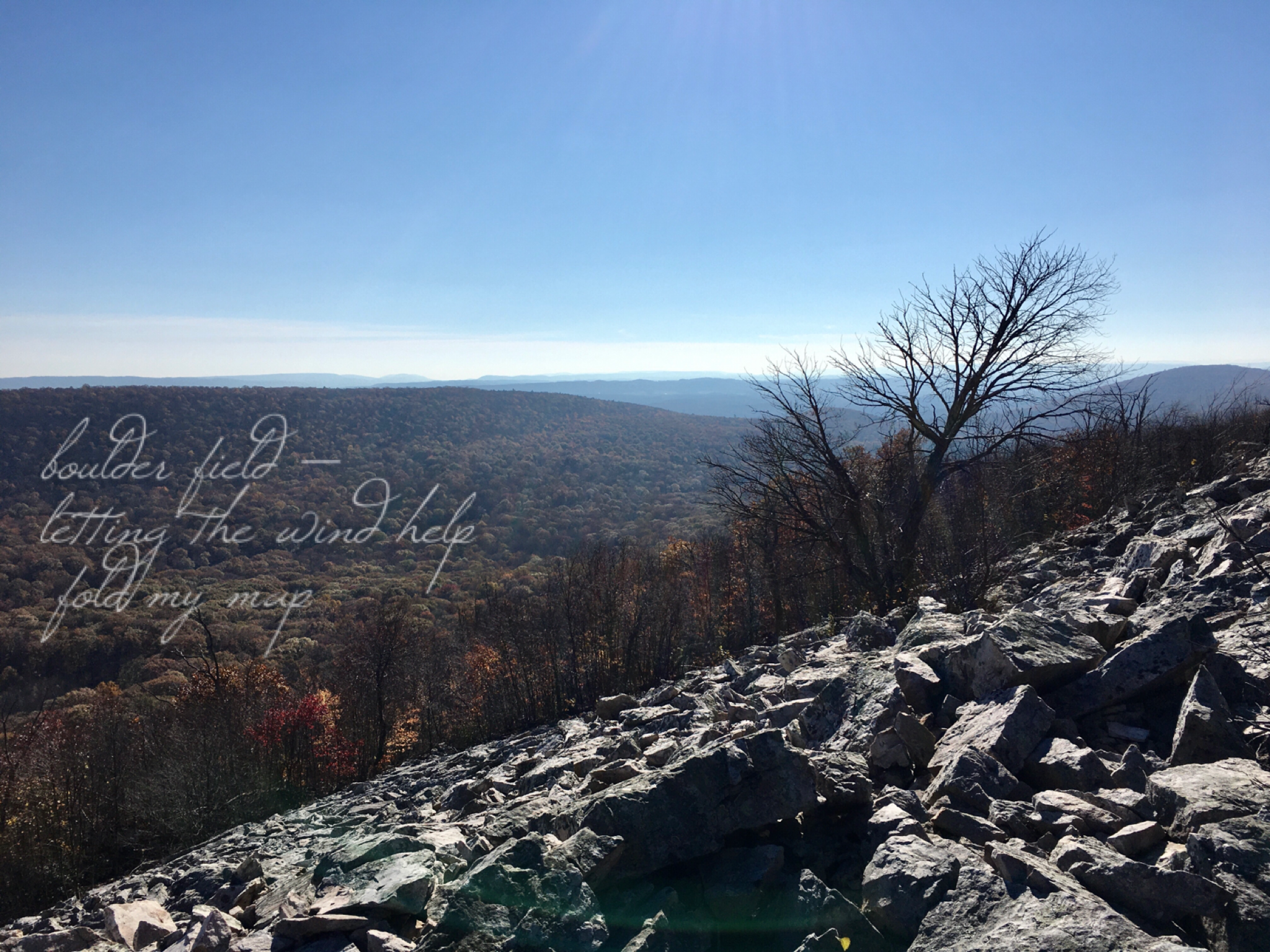
letting the wind help
fold my map
Despite what felt like the freshness of inspiration behind this ku, coming right after a haiku about bare sandstone and another that mentions a map, it does also feel like my brain’s in a rut. Sometimes subjects do reward extended engagement, of course, so writing multiple haiku on the same subject would seem like an obvious thing to do… except that the linked verse tradition out of which haiku evolved encouraged just the opposite: constant shifts in subject and season between adjacent verses (or pairs of verses) building upon the tendency for contrasting or disjunctive images right within a haiku.
Anyways. There’s no consensus among hikers and other outdoorsy people on what to call ridgetop or ridgeside outcrops of bare rock from the Tuscarora formation. In my family growing up, we first called them rockslides, but later on switched to talus slopes under the impression that was more accurate. But geologists tend to reserve talus for fallen rocks at the foot of a cliff; this is more properly a periglacial rock slope. You can see why I settled on boulder field, which usually implies a more level area, but what the hell. Down in West Virginia, a lot of actual fields are steeper than this.
One thing’s for sure, though. Mountaintop boulder fields are excellent Allegheny woodrat habitat!

In a rut or no, I like this one a lot.
Oh hey, thanks! I’m glad.